- Home
- Camp Wolters
- A Model Soldier
- Camera Trip Through Camp Wolters
- Camp Wolters Longhorn
- Camp Wolters Ephemera
- Camp Wolters Guide
- Camp Wolters IRTC
- Camp Wolters Postcards
- Camp Wolters Unit Photos
- Christmas Menu
- Present Site of Camp
- Southwestern Bell Booklet
- Camp Wolters Souvenir Book
- IRTC Doughboy
- Soldier - Billy S. West
- Soldier Artist
- Soldier's Letters
- Soldier's Photos
- Fort Wolters
- United States Primary Helicopter/School
- Flight Training
- ORWAC Class 68-24
- WORWAC Class 67-5
- Training Aircraft
- Stagefields and Heliports
- Southern Airways of Texas
- USAPHS Commandants
- Battery D, 4th Missile BN 562nd Arty
- 328th U.S. Army Band
- Det. 20, 16th Weather Squadron
- Guide and Directory
- Crash Rescue Map
- Dave Rittman Photos
- Fort Wolters Photo Gallery
- Fort Wolters Ephemera
- Wolters Air Force Base
- Fort Wolters Main Gate
- Around Mineral Wells
- Texas Forts Trail
- Vietnam
- Sitemap
- Links
- About the Site
- What's New
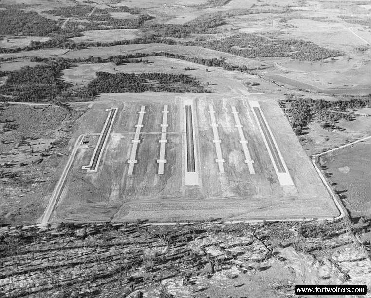
U.S. Army Photo - Private Collection |
|
|---|---|
Stagefield: AN KHE Latitude/Longitude:32°51'3"N 97°57'21"W Army Map Service Coordinates: NM977350 Telephone Number: None Field Elevation: 1010 ft Traffic Pattern Altitude: 1500 ft Radio Call: An Khe Frequencies: 231.2 - 143.30
GENERAL NOTES 2 Autorotation Lanes: 1600' x 50' each 4 Approach Lanes: 4 pads per lane - 30' x 30' 1 Refueling Lane No paved hovering area
No fixed lighting Electricity: Portable Generator, 10 KW
Windsocks: 2 - 1 each in SE and NW corners
Permanent Control Tower: Air conditioned, light gun
Radios: 2 ARC - 60 (UHF), 1 ARC - 524 (VHF)
All weather access road Distance from Fort Wolters : Air 4.9 N.M., Ground 9.2 S.M.
Ready Room: 8 Tables with chairs, no air conditioning, no water available at site, temporary latrines
Wind T: Located mid-field
Restricted Areas: Town of Garner, 3 KM SW, Do not fly within 500 meters radius of 1 house and field 1 mile NW.
Hazard: Stagefield terraced from lane to lane. Use caution when hovering across lanes.
|
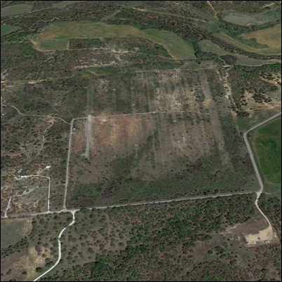
Present Day Aerial View |