- Home
- Camp Wolters
- A Model Soldier
- Camera Trip Through Camp Wolters
- Camp Wolters Longhorn
- Camp Wolters Ephemera
- Camp Wolters Guide
- Camp Wolters IRTC
- Camp Wolters Postcards
- Camp Wolters Unit Photos
- Christmas Menu
- Present Site of Camp
- Southwestern Bell Booklet
- Camp Wolters Souvenir Book
- IRTC Doughboy
- Soldier - Billy S. West
- Soldier Artist
- Soldier's Letters
- Soldier's Photos
- Fort Wolters
- United States Primary Helicopter/School
- Flight Training
- ORWAC Class 68-24
- WORWAC Class 67-5
- Training Aircraft
- Stagefields and Heliports
- Southern Airways of Texas
- USAPHS Commandants
- Battery D, 4th Missile BN 562nd Arty
- 328th U.S. Army Band
- Det. 20, 16th Weather Squadron
- Guide and Directory
- Crash Rescue Map
- Dave Rittman Photos
- Fort Wolters Photo Gallery
- Fort Wolters Ephemera
- Wolters Air Force Base
- Fort Wolters Main Gate
- Around Mineral Wells
- Texas Forts Trail
- Vietnam
- Sitemap
- Links
- About the Site
- What's New
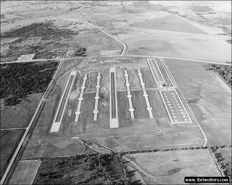
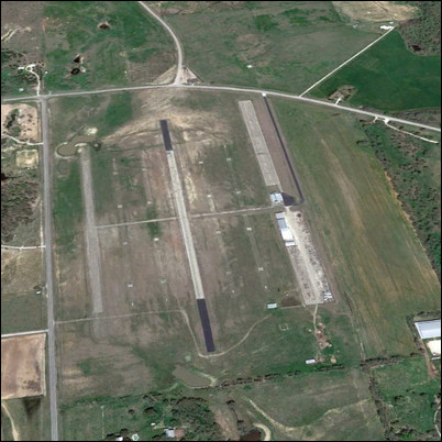
U.S. Army Photo - Private Collection |
|
|---|---|
Stagefield: BRONCO (Stagefield 6) Latitude/Longitude:32°54'28"N 97°58'34"W Army Map Service Coordinates: NM958414 Telephone Number: Fort Wolters Ext 3297 Elevation: 1053 ft Traffic Pattern Altitude: 1600 ft Radio Call: Bronco Frequencies: 229.7 - 148.90
GENERAL NOTES 2 Autorotation Lanes: 1600' x 50" each 4 Approach Lanes: 4 pads per lane - 30' x 30' Hovering Area: 178' x 880' (with 20 concrete parking pads) Refueling Area : 98' x 1120' (with 14 concrete parking pads)
Fixed Lighting: Lanes 3 6 - Runway Lights Lanes 1,2,4, &5 - Approach Lights
Parking Area: Lights on east and west side
Windsocks: 2: 1 in NE corner, 1 in SW corner
Permanent Control Tower: With light gun, air conditioned, flight training status lights, wind direction and velocity indicator.
Radios: 2 ARC - 60 radios (UHF) 1 ARC - 524 (VHF)
All weather access road
Distance from Fort Wolters: Air - 5.5 NM Ground - 9.8 SM
Ready Room: 10 tables with chairs, air conditioned, potable water, permanent latrines, blackboard, area map.
Wind T: Lighted, located mid-field
Restricted Areas: Do not fly over cemetery, 1.2 km south when burials are being conducted
Hazards: Two power lines 1 km east and 2.1 km north. One power line 1.8 km south.
|
|