- Home
- Camp Wolters
- A Model Soldier
- Camera Trip Through Camp Wolters
- Camp Wolters Longhorn
- Camp Wolters Ephemera
- Camp Wolters Guide
- Camp Wolters IRTC
- Camp Wolters Postcards
- Camp Wolters Unit Photos
- Christmas Menu
- Present Site of Camp
- Southwestern Bell Booklet
- Camp Wolters Souvenir Book
- IRTC Doughboy
- Soldier - Billy S. West
- Soldier Artist
- Soldier's Letters
- Soldier's Photos
- Fort Wolters
- United States Primary Helicopter/School
- Flight Training
- ORWAC Class 68-24
- WORWAC Class 67-5
- Training Aircraft
- Stagefields and Heliports
- Southern Airways of Texas
- USAPHS Commandants
- Battery D, 4th Missile BN 562nd Arty
- 328th U.S. Army Band
- Det. 20, 16th Weather Squadron
- Guide and Directory
- Crash Rescue Map
- Dave Rittman Photos
- Fort Wolters Photo Gallery
- Fort Wolters Ephemera
- Wolters Air Force Base
- Fort Wolters Main Gate
- Around Mineral Wells
- Texas Forts Trail
- Vietnam
- Sitemap
- Links
- About the Site
- What's New
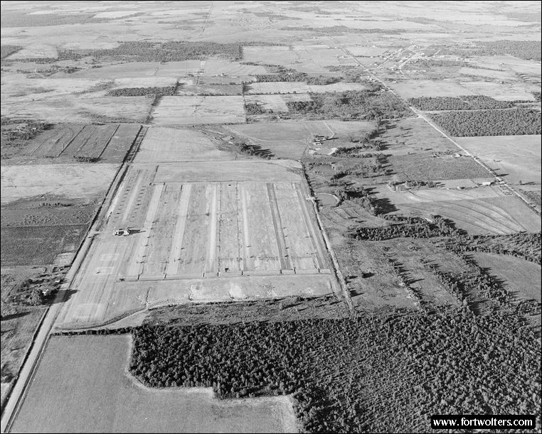
U.S. Army Photo - Private Collection |
|
|---|---|
Stagefield: MUSTANG (Stagefield 4) Latitude/Longitude:32°56'20" N 98°1'43"W Army Map Service Coordinates: NM909448 Telephone Number: Fort Wolters Ext 3223 Elevation: 1094 ft Traffic Pattern Altitude: 1600 ft Radio Call: Mustang Frequencies: 248.8 - 139.45
GENERAL NOTES 6 Lanes : 1600' x 50' each Hovering Area: 900' x 175' Parking Area: OH-23 - 26; TH-55 - 34 Fixed Lighting : Lanes 3 & 4 - Runway Lights Lanes 1, 2, 5, & 6 - Approach Lights
Electricity: Commercial Power
Windsocks: 5: 1 in each corner, 1 near tower
Permanent Control Tower: With light gun, air conditioned, wind velocity and direction indicator, flight training status lights.
Radios: 2 ARC - 60 radios (UHF) - Coverter PP-13 (ARC) 1 ARC - 524 (VHF) - Converter T-1012A (Motorola)
All weather access road
Distance from Fort Wolters: Air - 6.1 NM Ground - 1).5 SM
Ready Room: Air cooled, potable water, 20 tables with chairs, permanent latrine, area map, 1 blackboard.
Wind T: Lighted, located mid-field
Restricted Areas: Avoid hovering on south end of hovering apron.
Remarks: Windsock near stagehouse restrict tower operator's view of aircraft operating in parking area.
|
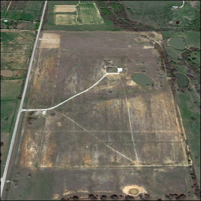
Present Day Aerial View |