
- Home
- Camp Wolters
- A Model Soldier
- Camera Trip Through Camp Wolters
- Camp Wolters Longhorn
- Camp Wolters Ephemera
- Camp Wolters Guide
- Camp Wolters IRTC
- Camp Wolters Postcards
- Camp Wolters Unit Photos
- Christmas Menu
- Present Site of Camp
- Southwestern Bell Booklet
- Camp Wolters Souvenir Book
- IRTC Doughboy
- Soldier - Billy S. West
- Soldier Artist
- Soldier's Letters
- Soldier's Photos
- Fort Wolters
- United States Primary Helicopter/School
- Flight Training
- ORWAC Class 68-24
- WORWAC Class 67-5
- Training Aircraft
- Stagefields and Heliports
- Southern Airways of Texas
- USAPHS Commandants
- Battery D, 4th Missile BN 562nd Arty
- 328th U.S. Army Band
- Det. 20, 16th Weather Squadron
- Guide and Directory
- Crash Rescue Map
- Dave Rittman Photos
- Fort Wolters Photo Gallery
- Fort Wolters Ephemera
- Wolters Air Force Base
- Fort Wolters Main Gate
- Around Mineral Wells
- Texas Forts Trail
- Vietnam
- Sitemap
- Links
- About the Site
- What's New
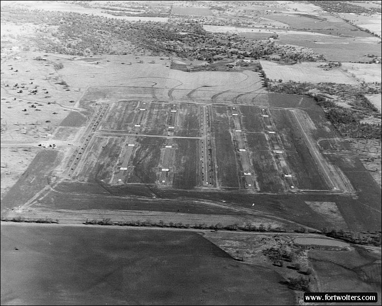
U.S. Army Photo - Private Collection |
|
|---|---|
Stagefield: PHU LOI Latitude/Longitude:32°42'42"N 98°6'59"W Army Map Service Coordinates: NM828194 Telephone Number: None Elevation: 1082 ft Traffic Pattern Altitude: 1600 ft Radio Call: Phu Loi Frequencies: 148.70
GENERAL NOTES 2 Autorotation Lanes: 1600' x 40' each 4 Approach Lanes w/4 pads per lane 30' x 30' (lighted) 1 Refueling Lane (lighted)
Windsocks: 2: 1 in each in NE and SW (lighted)
Permanent Control Tower: Air conditioned, light gun, wind velocity and direction indicator.
Radios Available in Tower: 2 ARC - 60 radios (UHF) - 1 ARC - 524 (VHF)
All weather access road
Ready Room: 6 tables with chairs, no air conditioning, no water available at site, temporary latrines.
Distance from Fort Wolters: Air - 8.0 NM - Ground - 14.5 SM
Restricted Areas: None
Remarks: None
|
|
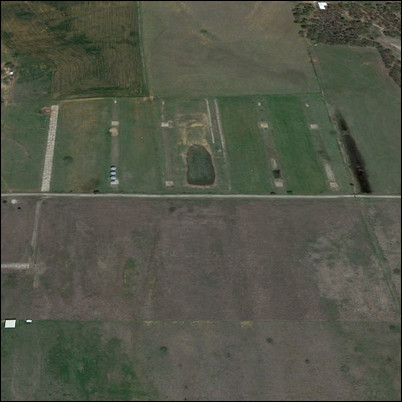 Present Day Aerial View