
- Home
- Camp Wolters
- A Model Soldier
- Camera Trip Through Camp Wolters
- Camp Wolters Longhorn
- Camp Wolters Ephemera
- Camp Wolters Guide
- Camp Wolters IRTC
- Camp Wolters Postcards
- Camp Wolters Unit Photos
- Christmas Menu
- Present Site of Camp
- Southwestern Bell Booklet
- Camp Wolters Souvenir Book
- IRTC Doughboy
- Soldier - Billy S. West
- Soldier Artist
- Soldier's Letters
- Soldier's Photos
- Fort Wolters
- United States Primary Helicopter/School
- Flight Training
- ORWAC Class 68-24
- WORWAC Class 67-5
- Training Aircraft
- Stagefields and Heliports
- Southern Airways of Texas
- USAPHS Commandants
- Battery D, 4th Missile BN 562nd Arty
- 328th U.S. Army Band
- Det. 20, 16th Weather Squadron
- Guide and Directory
- Crash Rescue Map
- Dave Rittman Photos
- Fort Wolters Photo Gallery
- Fort Wolters Ephemera
- Wolters Air Force Base
- Fort Wolters Main Gate
- Around Mineral Wells
- Texas Forts Trail
- Vietnam
- Sitemap
- Links
- About the Site
- What's New
U.S. Army Photo - Private Collection |
|
|---|---|
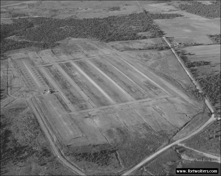
Stagefield: PINTO (Stagefield #1) Latitude/Longitude:32°52'42"N 98°0'31"W Army Map Service Coordinates: NM928380 Telephone Number: Ext 3219 Elevation: 1003 ft Traffic Pattern Altitude: 1500 ft Radio Call: Pinto Frequencies: 230.1 - 141.05
GENERAL NOTES 6 Lanes : 1600' x 50' each Hovering Area: 900' x 175' Parking Area: OH-23 - 26 ; TH-55 - 34
Fixed Lighting: Lanes 3 and 4 - Runway Lights; Lanes 1, 2, 5, & 6 - Approach Lights Electricity: Commercial Power
Windsocks: 5: 1 in each corner, 1 near tower
Wind T: Lighted, located mid-field
Permanent Control Tower: Air conditioned, light gun, wind velocity and direction indicator, flight training status lights.
Radios Available in Tower: 2 ARC - 60 radios (UHF) - 1 ARC - 524 (VHF)
Hard surface access road from heliport. Distance from Fort Wolters: Air - 3.3 NM - Ground - 4.6 SM
Ready Room: 11 tables with chairs, air cooled, permanent latrine, potable water, 2 blackboards, bleachers - seating outside for approximately 350.
Restricted Areas: None
Remarks: Ideal for demonstrations
|
|
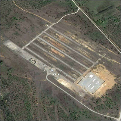 Present Day Aerial View